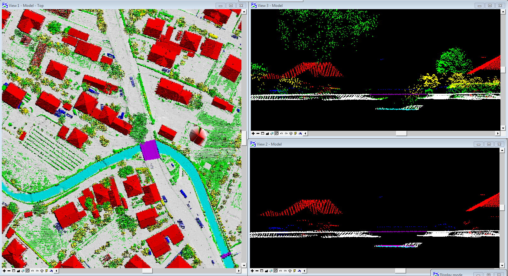
Aerial Lidar
Aerial Lidar typically involves scanning from an aircraft or helicopter depending on the site location, its geography and the terrain being surveyed (sensor in a horizontal, inclined, or vertical position). Our company resources having domain expertise will be allocated to process the aerial lidar data.
It includes –
- Advanced Classification
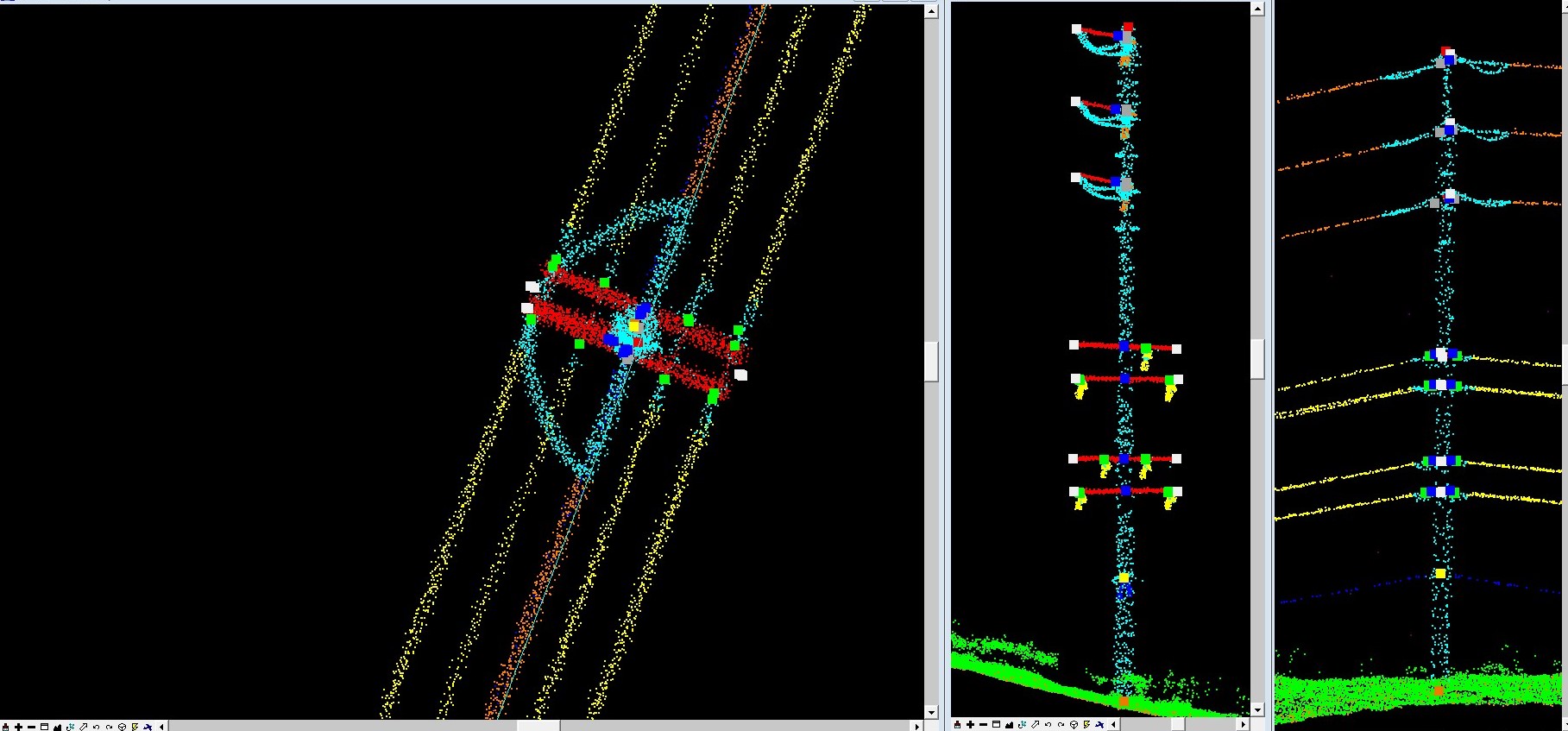
- Power line classification
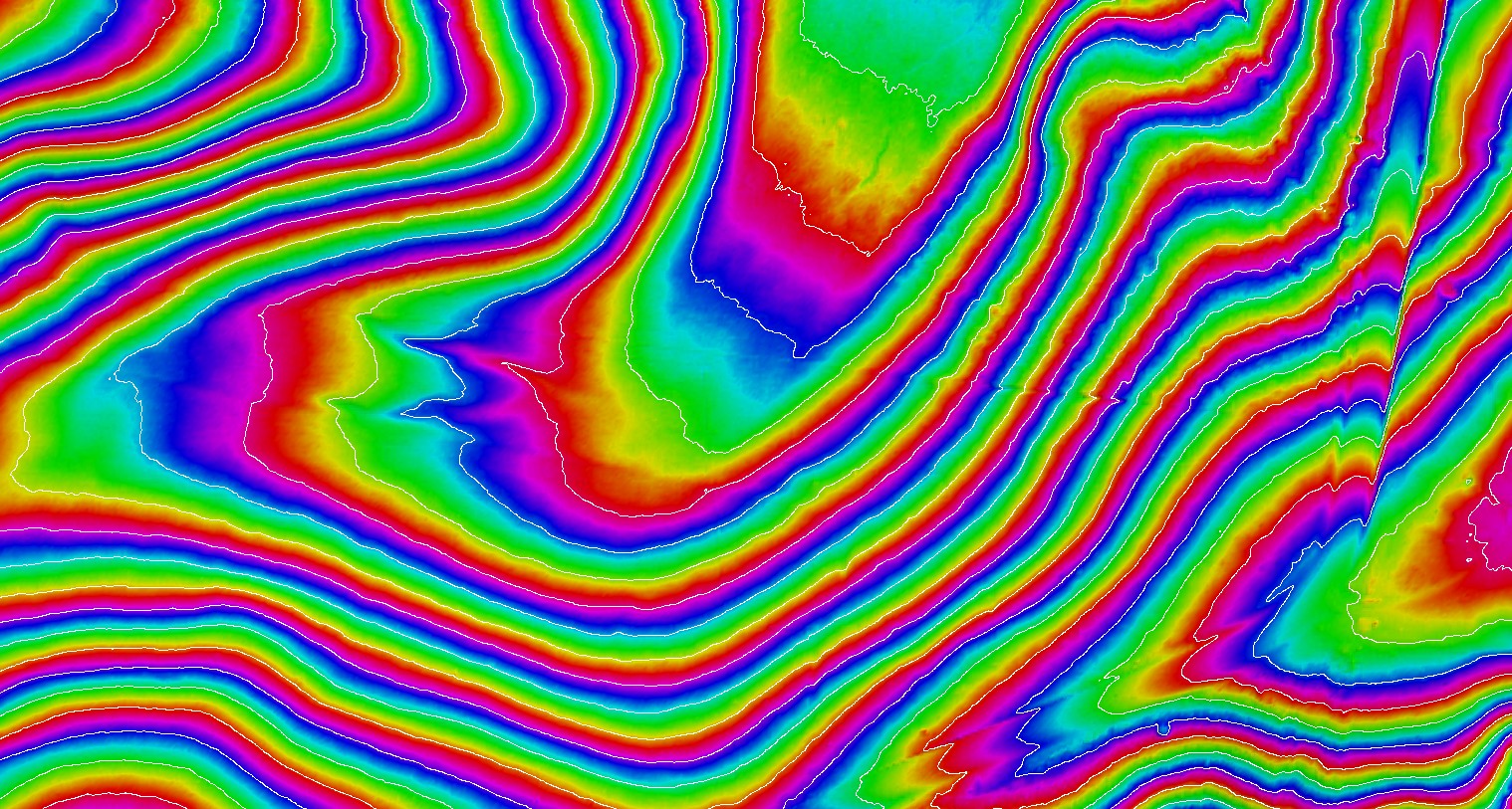
- Contour generation
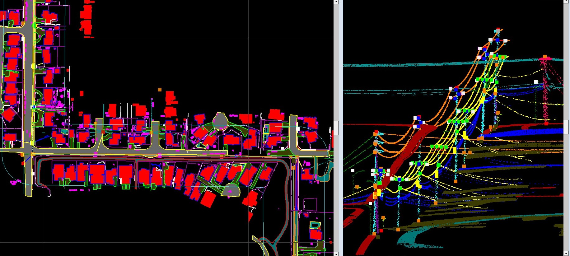
- 2D/3D feature extraction
- Data collection/ Data entry
- Hydro analysis and Hydro flattening processes
- Generation of DTM, DSM and Intensity images