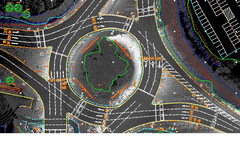
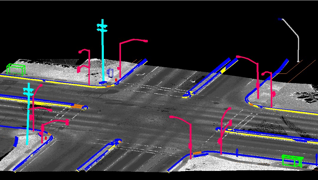
Mobile Lidar
Mobile LiDAR is an innovative mapping solution that incorporates the most advanced LiDAR sensors, cameras and position/navigation to collect survey-quality point data quickly and accurately. Mobile LiDAR offers numerous advantages over aerial mapping and conventional ground surveys. Our company resources having domain expertise will be allocated to process the mobile lidar data.
It includes –
- Classification of ground and non ground
- 2D feature extraction
- 3D Corridor mapping
- Generation of DTM, DSM and Intensity images